
Brochures & Maps
Please feel free to download and use it to plan your trip. Information may change.
【NOTE】 There is a limited amount of English information on Tsushima. Some of the tourist information centers may not have the following brochures or maps. It is recommended to print out all information before visiting the island. Maps are current as of summer 2013 and do not reflect recent changes.
【NOTE】 There is a limited amount of English information on Tsushima. Some of the tourist information centers may not have the following brochures or maps. It is recommended to print out all information before visiting the island. Maps are current as of summer 2013 and do not reflect recent changes.
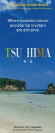
Tsushima Guidebook
All information including sightseeing, food, experiences, annual events, and accommodation.
|
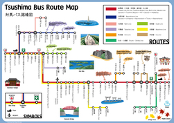
Tsushima Bus Route Map
A map with all the bus stops on the island. Note: There are no English on bus stop signs. The announcements on the bus are mostly in Japanese and sometimes in Korean. Please check here for bus timetable information (in Japanese).
| ||||||
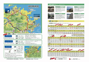
izuhara port
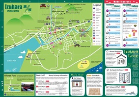
Izuhara Castle Town Walking Map
A map for day trippers and those who are visiting Izuhara. The map includes information on sightseeing, restaurants, model courses, and more on Izuhara port area.
|
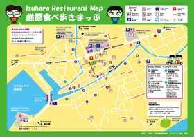
Izuhara Restaurant Map
A map focused on places to eat in Izuhara. Try some of Tsushima's unique dishes while you are here.
| ||||
hitakatsu port
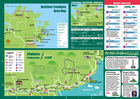
Northern Tsushima Sightseeing Map
A map for day trippers and those visiting Kamitsushima. The map includes information on sightseeing, restaurants, model courses, and more on Hitakatsu port area and northern Tsushima.
|
Hitakatsu Area Map
A map on Hitakatsu port area (not an English map). Includes bus schedules that goes around northern Tsushima, and the ones that goes to the airport and to Izuhara.
| ||||
other maps
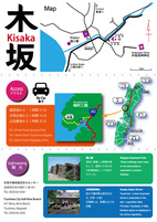
Kisaka Area Map
Kisaka is a small village located in Mine town. Here you can see Kisaka Kaijin shrine, the most important shine on Tsushima and unique buildings called Mogoya seaweed huts.
| |||
