
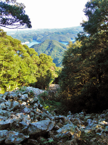
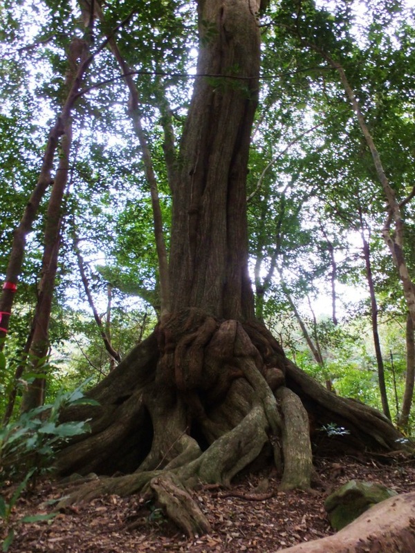
Many ancient forests and woods still remain on the island. Tsushima's mountains are relatively short, but anything can be dangerous if you don't know the area or if there's bad weather. All the places listed here have marked trails and can be hiked without special equipment, but always exercise caution while hiking. Stroll through the primeval forests. Feel the fresh air and majestic natural scenery. Tsushima's mountains will always greet hikers.
Notes
|
RatingsScenery
★★★★★ Excellent/ Rewarding ★ Bad/ Surrounded by trees or bushes Danger
★★★★★ Equipment necessary ★ Safe/ No specific hazards Difficulty
★★★★★ Challenging/ Long ★ Easy/ Short |
Inclination Symbols

Flat |

Gentle Slope |

Moderate Slope |

Steep Slope |
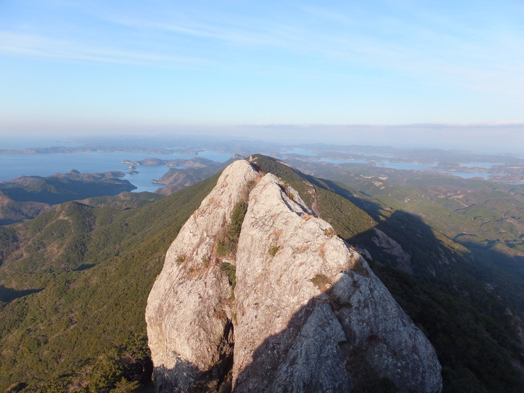
Mt. Shiratake 【白嶽】
|
Located in Sumo, Mitsushima town (美津島町洲藻)
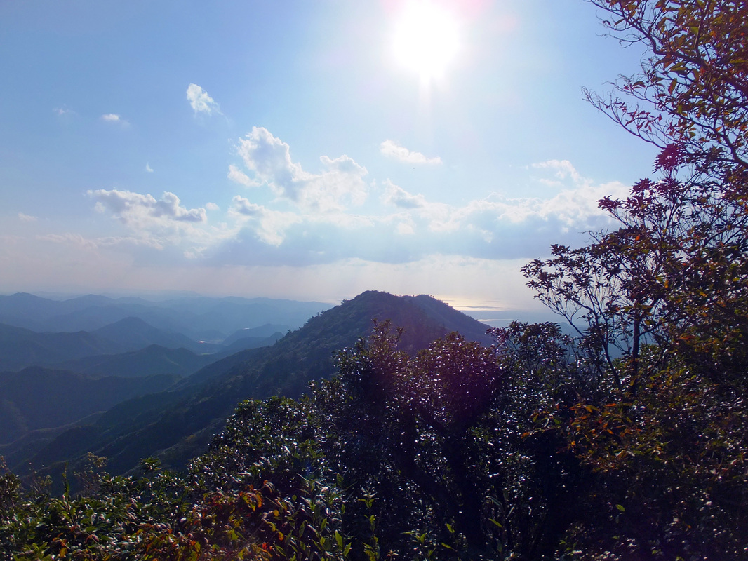
Mt. Shiratake is composed of quartz porphyry and is a symbolic sacred mountain of Tsushima. The mountain is also designated as a national natural treasure for its peculiar ecological system, having vegetation of Japanese and continental environments. You will experience the beautiful nature and the 360° panoramic view at the summit of Mt. Shiratake. 15 min from Tsushima airport, 25 min from Izuhara port by car |
Mountain Data
|
Elevation: 519 m
Length: 2.2 km Time Needed: 75 min Scenery ★★★★★
Danger ★★★★ Difficulty ★★★★ |

|
Kaneda Castle Ruins 【金田城跡】
|
Located in Kurose, Mitsushima town (美津島町黒瀬)
In the second year of the Tenji Era (663), the Japanese army was defeated in the battle of Baekgang by the allied forces of China's Tang Dynasty and the kingdom of Korea. Tsushima, which became the foremost line of Japan's national defense, prepared for an invasion from the continent. On the south bank of Aso Bay, they built the Fortress of Kaneda on the towering castle mountain as a strategic point of defense. The living remains include three castle doors and a surrounding stone fortress. At the summit, one can see the distant South Korea when the weather is fine. 15 min from Tsushima airport, 25 min from Izuhara port by car |
Mountain Data
|
Elevation: 272.8 m
Length: 2.6 km Time Needed: 50 min Scenery ★★★★★
Danger ★★ Difficulty ★★ |

|
Shimizuyama Castle Ruins 【清水山城跡】
|
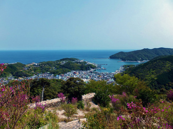
Located in Izuhara town (厳原町)
Shimizuyama is a 206m high mountain that overlooks Izuhara, Tsushima's largest town. Toyotomi Hideyoshi ordered the construction of a castle on the mountain as part of his ill-fated plan to conquer Korea in the 1590s. Today, remnants of the castle's 3 walls still feature prominently on the mountain. Handwritten multilingual signs guide the way. Shimizuyama can be combined with a hike of Mt. Ariake (see below). 20 min walk from Izuhara port |
Mountain Data
|
Elevation: 206 m
Length: 500 m Time Needed: 30 min Scenery ★★★★
Danger ★★ Difficulty ★ |

|
Mt. Ariake 【有明山】
|
Located in Izuhara town (厳原町)
Mt. Ariake was featured in the Manyo-shu, the oldest collection of Japanese poetry. The starting point is the same as Shimizuyama castle ruins. Stroll through the primeval forest and enjoy the fresh air and sounds of the wild birds. Iki island and Okinoshima island can be seen on fine days. 20 min walk from Izuhara port |
Mountain Data
|
Elevation: 558 m
Length: 2.9 km Time Needed: 105 min Scenery ★★★
Danger ★★ Difficulty ★★★ |

|
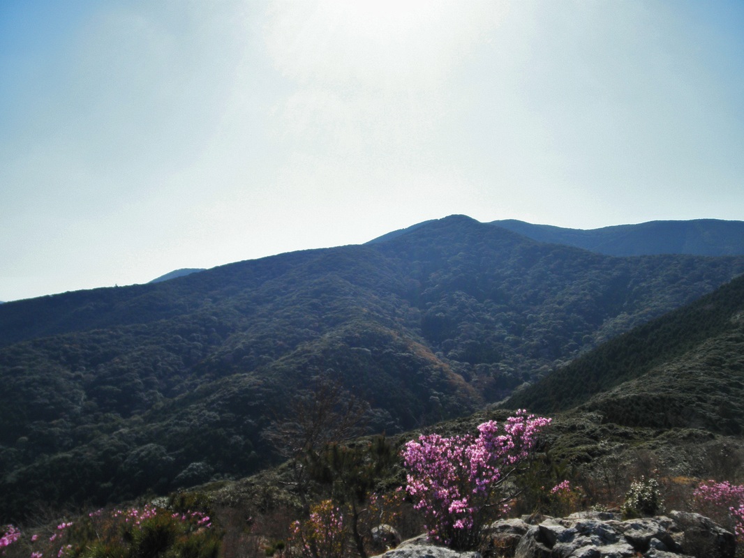
Mt. Tatera 【龍良山】
|
Located in Uchiyama, Izuhara town (厳原町内山)
Mt. Tatera is 559 m above sea level. Its primeval forest, on the north side slope, extends from the 120 m above sea level lowland up to the mountain's peak. From the vicinity of the 350 m boundary, a beech grove in the lower region and an oak grove in the upper region are developing. The whole area is an extremely delicate existence. 30 min from Izuhara port by car |
Mountain Data
|
Elevation: 559 m
Length: 2.8 km Time Needed: 100 min Scenery ★★★
Danger ★★★ Difficulty ★★★★ |

|
Mt. Mitake 【御岳】
|
Located in Kamiagata town (上県町)
The district of Kamiagata's peak has been revered from ancient times as a sacred mountain. The mountain is famous for its thickly grown primeval forest untouched by human hands, and as a migration point for white-tailed eagles. A 1920 survey confirmed that the phantom bird "kitataki" (Tristram's woodpecker) inhabited the area. Subsequently, although people have heard their calls and the rustle of the trees, they are no longer seen, and it is thought that they've gone extinct. 45 min from Hitakatsu port by car. 1.5 hr drive from Izuhara port |
Mountain Data
|
Elevation: 479 m
Length: 1.5 km Time Needed: 60 min Scenery ★★★★
Danger ★★ Difficulty ★★★ |

|
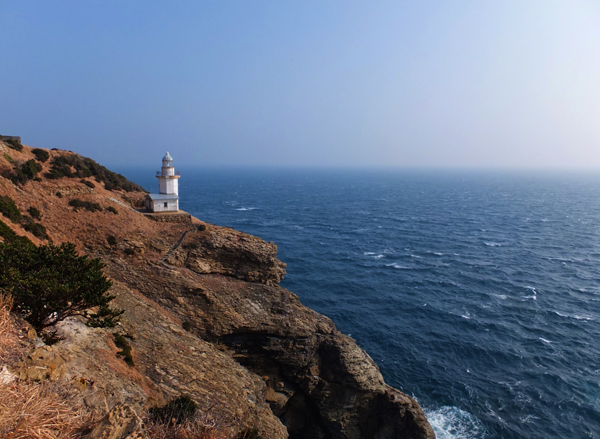
Kouzaki Peninsula 【神崎半島】
|
Located in Azamo, Izuhara town (厳原町浅藻)
Explore the southernmost point of Tsushima island and discover the gold fountain, Kouzaki lighthouse, and more! The starting point is located in Azamo district. Walk along the coast and you will see the entrance with a sign. It is about a 2 hour trek to the lighthouse and the trail is marked, but it is crumbling in some areas. Trail map (Japanese) 40 min by car from Izuhara port |
Trekking Data
|
Elevation: 52 m
Length: 5 km Time Needed: 120 min Scenery ★★★★★
Danger ★★★ Difficulty ★★★★ |

|
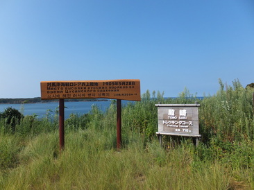
Tonosaki Trekking Course 【殿崎トレッキングコース】
|
Located in Nishidomari, Kamitsushima town (上対馬町西泊)
The starting point is located at Tonosaki park. The trail is flat and easy to walk through. On the way, you will see a sign indicating where Russian soldiers landed during the Russo-Japanese war. Although it is a very easy trek, tall grasses and bushes might make it difficult to try depending on the season. 4 min by car, 15 min by bike, 30 min walk from Hitakatsu port |
Trekking Data
|
Elevation: -
Length: 710 m Time Needed: 15 min Scenery ★★★★
Danger ★ Difficulty ★ |

|
